foucault map

With a database of images, texts, charts and historical maps, Mapping Gothic France lets you explore parallel stories of Gothic architecture and the formation of France in the 12th and 13th centuries, and in other way, one can get lost in this Labyrinth of Knowledge and magnificante imageries of Gothic Churches,
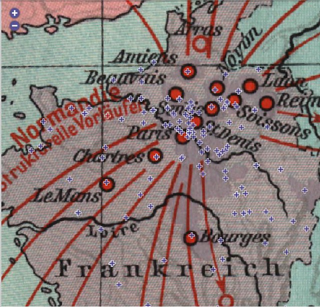
spread-map of gothic franch via steven green
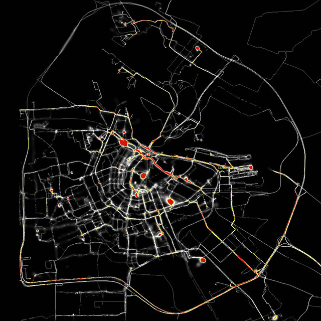
The most beautiful example of cartography in motion is Esther Polak’s “Amsterdam RealTime: Diary in Traces,” where GPS-equipped pedestrians sketch out the city plan of Amsterdam as a record of their everyday itineraries. Their paths appear as lines of light on a black ground, only to be gradually effaced, giving way to the traces of other walkers. But the work is a fragile gesture, fraught with ambiguity: the individual’s wavering life-line appears at once as testimony of human singularity in time, and proof of infallible performance by the satellite mapping system.
New book about the history of graphic representations of time, 'Cartographies of Time - A History of the Timeline', by Daniel Rosenberg and Anthony Grafton, writes about the subjects while handing us some rare and beautiful maps, charts and diagrams.
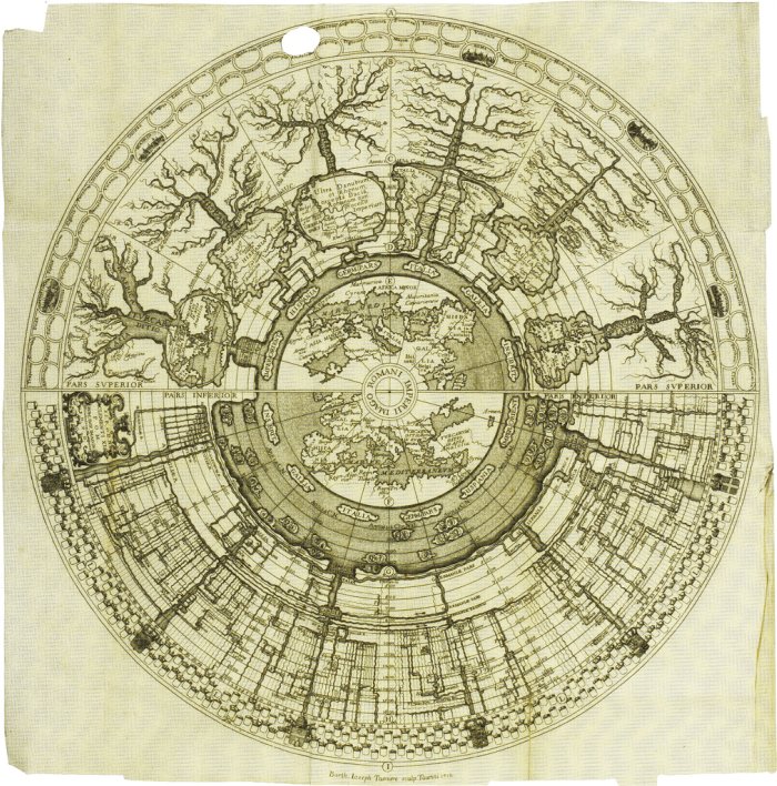
'Spiegazione della Carta Istorica dell'Italia' (Historical map of Italy) by Girolamo Andrea Martignoni
*
Edward Quin’s 1828 “Historical Atlas” used a series of maps to show changes in the world’s political divisions. In successive maps, the clouds roll back to reveal how much of the world was known to the West at the time. The map at left shows the state of the West at the time of the death of Emperor Constantine, in 337.
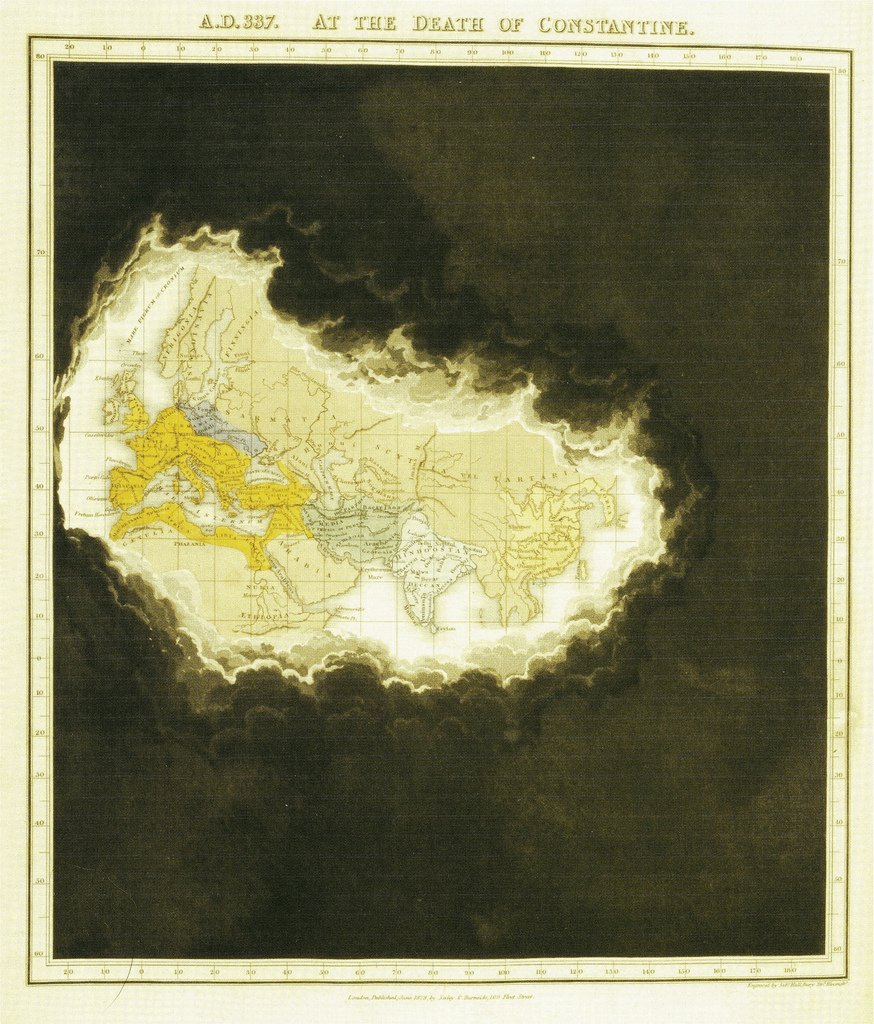
via Bibliodyssey

Jack Kerouac. “NIGHT NOTES & Diagrams for ON THE ROAD.” Manuscript notes for the novel, November 1949. New York Public Library, Berg Collection, Jack Kerouac Archive.
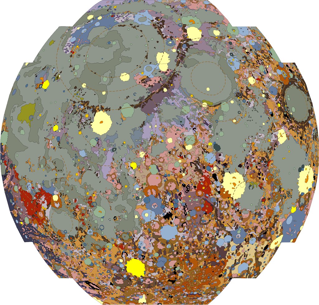
Gems of pure beauty, found buried in a government website. and found at the radicalcartography web site
while i was looking for inspirational ideas for a new books case for my new appartement, i stumbled upon the Ron arad's made of America book case.

Made of America: Bookcase Shaped Like the 50 States via 2leep
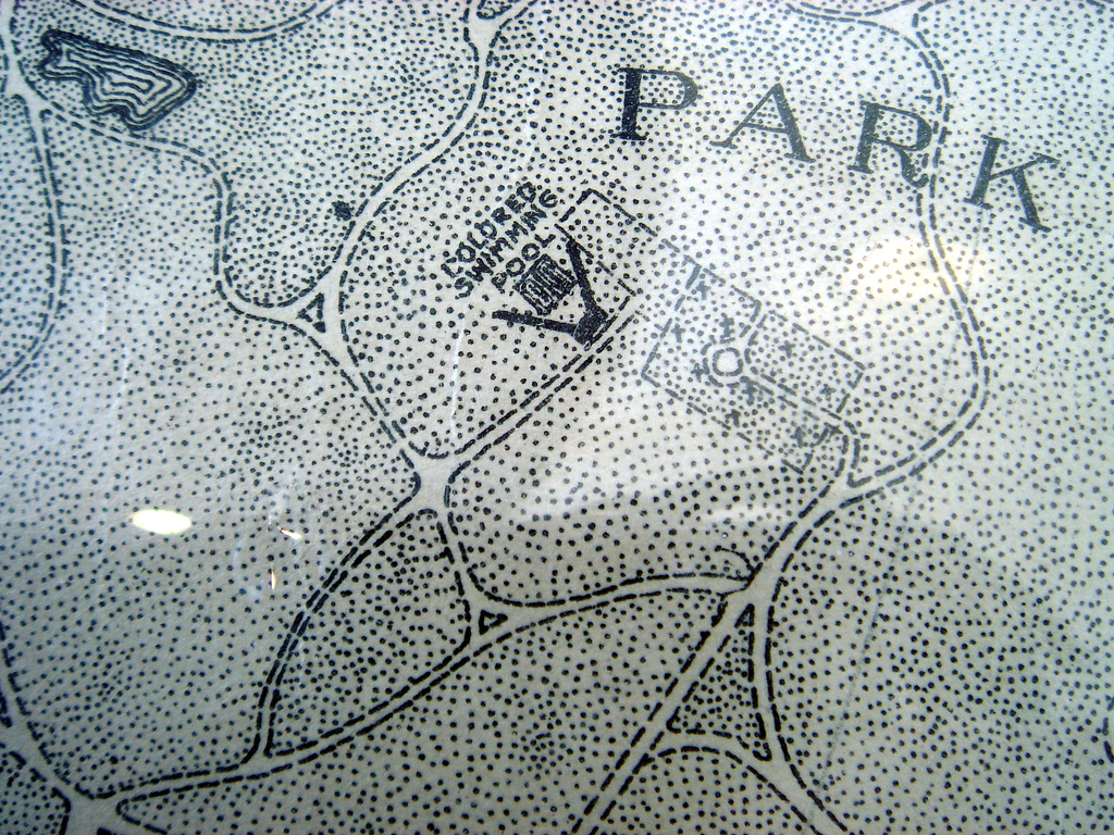
sevensixfive geeking out at the abstract textures and hand drawn detail of an old (1926) map of Baltimore. via ffffound

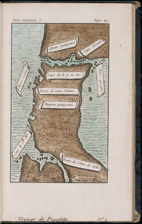
Antonio Pigafetta (c. 1491 – c. 1534), was an Italian navigator. He paid a large sum of money to accompany and assist the Portuguese captain Ferdinand Magellan and his Spanish crew on their trip around the world. During the voyage, he kept an accurate journal.
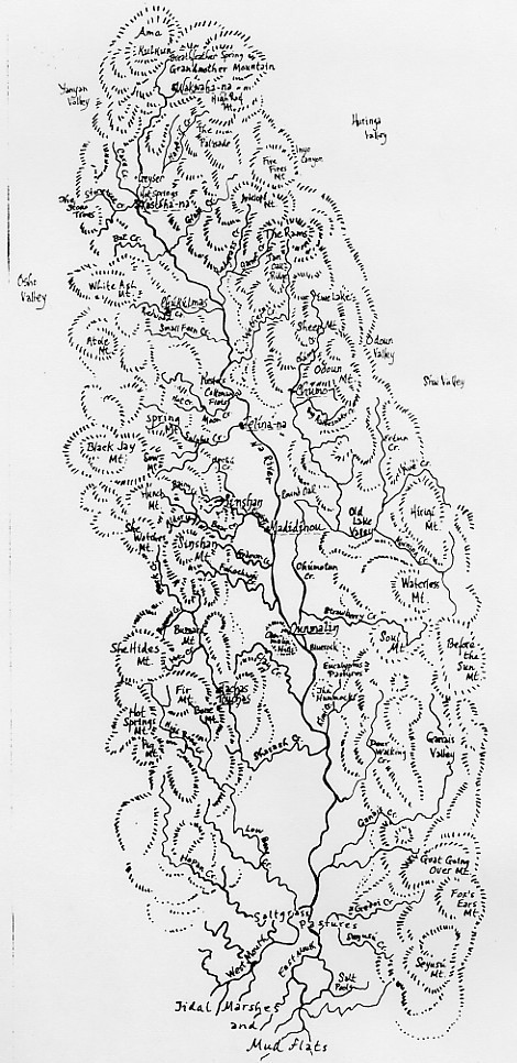
This Stone From the Serpentine heyimas of Telina-na; by Wordriver
by Ursula Le Guin. {Illustrated by Margaret Chodos-Irvine }
xxxxxxxxxxxxxxx
He went looking for a road
that doesn't lead to death.
He went looking for that road
and found it.
xxxxxxIt was a stone road.
He walked that road
that doesn't lead to death.
He walked on it awhile
before he stopped,
xxxxxhaving turned to stone.
Now he stands there on that road
that doesn't lead to death
not going anywhere.
He can't dance.
xxxxxFrom his eyes stones fall.
The rainbow people pass him
crossing that road, long-legged, light-stepping,
going from the Four Houses
to the dancing in the Five Houses.
xxxxxThey pick up his tears.
This stone is a tear
from his eye, this stone
given me on the mountain
by one who died before my birth,
this stone, this stone.
via and interconnected

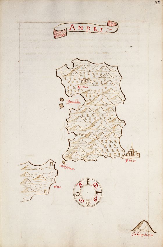
Maps by Millo Antonio From an isolario (island book) of the Mediterranea... and many of them are Greek Islands, my new passion

[Lesbos and the adjacent coast of Asia Minor] 1590

Antonio Millo, 1590 manuscript Bound sheet. Ms. 31 x 20.5cm
"Maps are older than writing and are possibly older than language" it is explained by the simple fact that "given the importance of spatial location to survival, it seems reasonable that early humans would find some way to physically embody the maps stored between their ears. "
But This article discusses mainly the candidates for the world’s oldest map and the criteria involved: what makes a map a map and not a painting.


.jpg)